New Project!! Zapote-Camilo
- Bram van den Heuvel
- Dec 8, 2025
- 2 min read
Updated: Mar 5
!!Downloadable map at the bottom!!
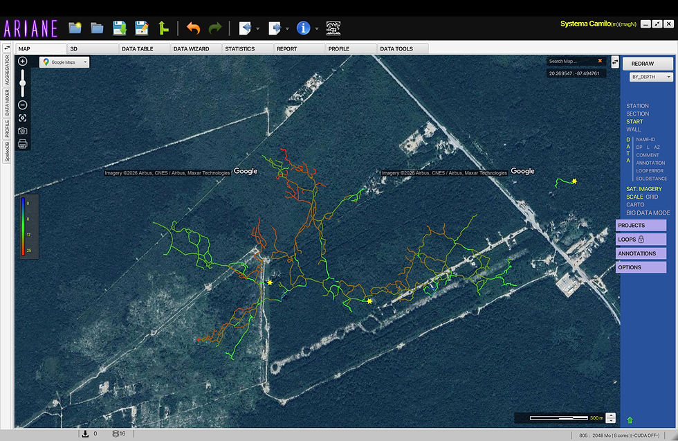
Project Zapote-Camilo

After finishing the map of Xulo, it was time for a new project.
I really enjoyed the creativity aspect of cartography, and it awakened some ideas. We also received a lot of requests / questions on we did not include the lines on the map. So this time I decided to create a stickmap, but with illustrations.
The idea is to improve the traditional stickmap with some additional practical information. This is helpful when planning a dive, and at the same time makes it visually appealing.
To name a few differences:
I used swim times instead of distances (meters / feet) and the illustrations show points of interest, either for things to expect, or of cool stuff to see and visit.
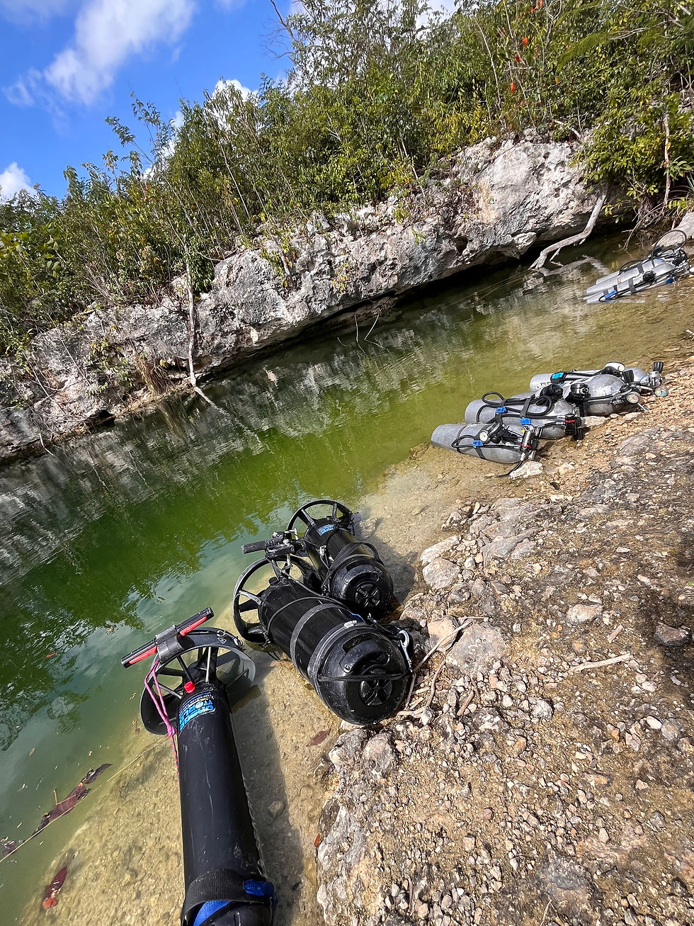
When choosing the cave to use for this project, I was looking for a good resurvey cave with interesting passages (which also had fun pre-existing names) with a chance of further exploration. But to be fair, proximity also played a big role in this decision as well, since one of the cave entrances was practically in our own backyard.

Systema Zapote-Camilo is a beast with approximately +40km in passages. We are not sure yet on the boundaries of the map, although connection to Ich Tunich and furthering the upstream is a sure thing.
Also we have been lucky enough to be adding some passage and extending the cave ourselves.

As the illustrations take a lot of time to create, I have decided to release a first version. This will include everything in swimming distance from Carries Loft. Survey in the Muchachos area is finished but illustrations are incomplete. The downstream section is also resurveyed close to the Coba-Tulum highway, but also awaiting illustrations.
Download the first draft below and keep an eye out on the website or social media for expansions of the map.


Comments